| Beverly Area Planning Association | Cook | Corridor Plan | The Beverly Area Planning Association seeks RTA assistance to conduct a corridor study along South Western Avenue from Evergreen Park at 83rd Street to Vermont Street in Blue Island. Jurisdictions included in the study area are the City's of Blue Island and Chicago, the Village of Evergreen Park, and the Illinois Department of Transportation. Pace and CTA both operate bus service along the study area as well as seven routes that cross Western Ave. The goal of this study is to identify opportunities to improve safety, mobility, and economic vitality along the corridor, with special attention to non-motorized access, and mobility and transit improvements. An equitable and multimodal implementation plan is the end goal for the corridor study, identifying upgrades to ADA requirements, improving safety and mobility, consolidating vehicular access, improving pedestrian access to big box retail, improving including signal timing and phasing, expanding access to jobs, education, and healthcare, improving the reliability of transit service, and improving the resiliency of utilities in the study area. |
| Chicago Department of Planning and Development* | Cook | Corridor Plan | The Chicago Department of Planning and Development seeks assistance to conduct a corridor study of Archer Avenue, from Halsted to Cicero, to evaluate land use, zoning and development opportunities with a focus on areas around the CTA Orange Line stations. The City will use the plan to identify key development opportunities along the corridor, align vision for the corridor with land use and zoning recommendations, and create a strategic implementation plan for the Archer Ave corridor. The study team will include the Chicago Department of Transportation to understand opportunities for enhanced pedestrian mobility and safety, bike lanes and mobility hubs, and ways to leverage the CTA public transit assets. The City desires to increase transportation resilience along the corridor as well as identify strategies to attract investment and encourage transit-oriented development in a way that will attract new retail development and jobs while retaining existing businesses. |
| Far South CDC | Cook | eTOD Plan | The Far South Community Development Corporation (CDC) seeks RTA assistance to develop a resident-driven eTOD plan in West Pullman, in areas just west of the West Pullman station on the Metra Electric line. The project would identify residential options for qualified buyers and renters seeking to make the neighborhood a destination to raise their families in high quality, transit-friendly housing near amenities that will provide supportive wrap-around educational services to help them achieve their goals. As the residential portion of this area will see an increase in population, the project will also include strategies for the development of complementary commercial and community spaces to house cafes, retail shops, and office space, along with the development of a community park and amphitheater, community welcome center and holistic health center. The plan would also include a transportation section with a focus on understanding what is necessary to increase ridership along the Metra Electric line and how to implement the relevant recommendations identified in the recently completed Major Taylor Trail Framework Plan. |
| Far South CDC | Cook | Mobility Hub | The Far South Community Development Corporation (CDC) seeks RTA assistance to develop a resident-driven Mobility Hub plan in West Pullman, in areas just west of the West Pullman station on the Metra Electric line. The project would identify residential options for qualified buyers and renters seeking to make the neighborhood a destination to raise their families in high quality, transit-friendly housing near amenities that will provide supportive wrap-around educational services to help them achieve their goals. As the residential portion of this area will see an increase in population, the project will also include strategies for the development of complementary commercial and community spaces to house cafes, retail shops, and office space, along with the development of a community park and amphitheater, community welcome center and holistic health center. The plan would address the primary concerns of bicycle access to transit as well as storage near transit, pedestrian infrastructure, and the need for a Mobility Hub to facilitate multi-modal transfers |
| Garfield Park Right to Wellness Collaborative | Cook | Corridor Plan | The Collaborative seeks RTA assistance to conduct a corridor study along portions of Madison Ave. in the City of Chicago, in the communities of East Garfield Park and West Garfield Park. The priority outcomes of the study are to broaden diversity in housing choices, attract investment and development and encourage transit-oriented development. The Collaborative seeks to identify transportation strategies that improve ADA accessibility and bicycle and pedestrian facilities while addressing sidewalk gaps along Madison. Economic strategies for the corridor are to attract new retail development and new jobs while retaining the existing businesses along the corridor. |
| Hazel Crest | Cook | eTOD Plan | The Village Hazel Crest seeks RTA support to develop an eTOD Plan for areas west of the Hazel Crest Metra station, leveraging the transportation assets in the area to balance investment and begin to deliver community benefits through greater pedestrian, bicycle and commuter activity. The Village would use a new plan to coordinate Village, County, state and federal resources for the station area, which has experienced disinvestment relative to the rest of Hazel Crest. Having TOD related investment would also further Village goals to create an Arts District in the study area, with programming and related building improvements to Village-owned vacant buildings, with the intension to convert into an adaptive reuse as a Center for the Arts. Improved pedestrian walkability and added bicyclist safety installments would benefit artists and the overall residential and commuter base living near the Hazel Crest Metra station. Lastly, the Village would like to identify further investment in the area for higher density, high quality multi-family workforce housing that would serve a number of workers with high quality housing near the Metra station, with quality amenities at a reasonable price point that does not exist today. |
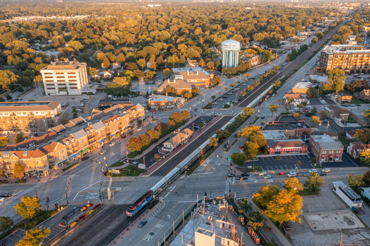
| Itasca | Cook | Special Financing District | The Village of Itasca is at the outset of exploring more complex financial incentives for development, and they seek RTA assistance through a Financing Study to provide a strong foundation upon which future successes could occur. The goal of the study is to ensure the Village has well thought out financial incentives to match regulatory updates and private investments that will help to bring the Downtown Itasca Strategic Action Plan into reality. In addition to a broader look at tools to facilitate economic development, the Village seeks assistance in crafting an effective TIF application and guidelines, in addition to facade program guidelines. The study area encompasses the established Downtown North TIF District, which generally encompasses the parcels on the north side of Irving Park Road in Itasca from Interstate 290 on the west to Rush Street on the east, which includes parcels surrounding the Itasca Metra station. |
| Itasca | Cook | Zoning Code Amendments | The Village of Itasca seeks RTA support for zoning code updates that will allow the types of development envisioned in the Village's adopted Downtown Itasca Strategic Action Plan, completed through the RTA's Community Planning program. The Village's existing code needs modifications to modernize the code to better align with best practices and other Village initiatives. Zoning amendments will be centered on downtown Itasca and areas surrounding the Itasca Metra station, and will include such tasks as drafting tables for dimensional standards as well as uses, address parking ratios for mixed use developments, develop unified design guidelines for Downtown Itasca, as well as develop specific guidelines for the Itasca Historic District. |
| LaGrange* | Cook | Corridor Plan | The Village of La Grange seeks RTA assistance to conduct a study or the South La Grange Road corridor, from 47th Street to the Village limits at Plainfield Road, bringing equity to this section of La Grange Road, and making the entire La Grange corridor more cohesive through the entire Village. The Village intends to make this street more friendly for pedestrians, cyclists, and transit users, many of whom have stated they have fears walking and biking to nearby downtown, even though it is only a short distance, due to safety concerns and a lack of infrastructure. The goals of the study include strategies to complete gaps in the sidewalk network, upgrade facilities to ADA standards, identify needed streetscape improvements, improve access for pedestrians and transit users to the commercial, retail and housing units along the corridor, and re-balance auto-oriented nature of La Grange Road that exists today. |
| Lockport | Will | eTOD Plan | The City of Lockport seeks RTA assistance to develop an eTOD Plan for the downtown area of Lockport including the area surrounding the Lockport Metra station. The study area encompasses the National Historic District, future growth areas south of the Metra station, north to connect with the Star Innovation District and a changing neighborhood east to Madison, inclusive of the Freshman Center in the historic Central High School. The goals with the new plan would be to update the original 2009 downtown plan to reflect the changes that have occurred over the past 15 years in the central downtown and extend the study area south to capture the underserved Fairmount area and the Taft School District. Both areas are heavily reliant on residential tax dollars which have been lacking. The City would like to build off continued success in the central downtown to identify the future for some legacy properties that could be improved and generate additional revenue in the southern portions of the study area. The City would like to extend the plan north to contemplate changes that will occur as a result of the Star Innovation District and the frontage along State Street on both the east and west sides of the street. |
| Maywood* | Cook | Corridor Plan | The Village of Maywood seeks RTA assistance to conduct a study of the Roosevelt Road corridor in southern portions of the Village, from 1st Avenue on the east to 13th Avenue on the west. The goal of the Roosevelt Road Corridor plan is to identify immediate, near term and long-term opportunities for, as well as the feasibility of a number of economic development projects including, the potential for infill housing, mixed-use development, and the bolstering of commercial development along the corridor. Additionally, they seek to improve the curb appeal and pedestrian access to transit, businesses, and the Hines VA Hospital, Madden Mental Health Center, and Loyola's Medical campus. By partnering with adjacent villages, institutions, and stakeholders the Village will be able to better to coordinate a more detailed plan for the corridor's future, creating a more accessible and safe environment for the community. |
| Morton Grove | Cook | Corridor Plan | The Village of Morton Grove seeks RTA assistance to develop the Dempster Street Corridor Plan. The study area would travel the length of Dempster Street from Central Avenue on the east to Harlem Ave on the west, within the Village limits. Over the past two decades, major shifts in transportation infrastructure, demographics, the environment, and the economy have affected the established Dempster Street corridor and produced new challenges. An updated Dempster Street Corridor Plan will help Morton Grove respond to those shifts and address emerging issues head-on. The recent addition of Pace’s Pulse bus rapid transit service have improved Dempster Street’s function as an efficient transportation corridor. However, issues related to shallow lot depth, access management, evolving parking needs, and adjacency to established single-family neighborhoods have hindered the corridor’s ability to function as an economic engine for the community. The Corridor Plan is needed to provide a cohesive vision for Dempster Street that identifies parking solutions, leverages and connects transit assets, expands retail and employment-generating development, and identifies complementary opportunities for new housing. The Village desires a new vision for the Dempster Street corridor to encourage reinvestment, support existing and future business, and provide needed services and amenities to the community. In addition, the Village hopes to broaden diversity in housing choices along the corridor, attract investment and development, and better manage parking. |
| Mount Sinai Hospital Medical Center | Cook | Mobility Hub | The Medical Center seeks RTA assistance to develop a Mobility Hub in the vicinity of Ogden Avenue and California to broaden transportation connections and access to safe transit connections. The objective is to create safer travel in the form of bike paths, safer crosswalks, ADA accessibility, signage, lighting, protection from vehicular threats, vehicle speed restriction, and safer pedestrian access to transit services, Douglass Park, the hospital, schools, other major Chicago employers in the nearby area. Components of the Mobility Hub could include bicycle storage near transit stops, connections to bicyclist infrastructure (trails, paths, lanes, etc.), improved facilities for multi-modal transfers, better pedestrian infrastructure (sidewalks, crossings, etc.), and access to shared parking and electric vehicle charging stations. |
| Palos Park | Cook | Transportation Safety Plan (Neighborhood Mobility Improvement Plan) | The Village of Palos Park seeks RTA assistance to improve transit access for people walking and biking in the area centered on Southwest Highway and its intersections with Timber Lane and 121st Street, in Palos Park. The proposed study area includes the Palos Park Metra Station, the northerly access of which is off of 121st Street. The Village goals are to identify strategies for pedestrian, bicycle, and ADA compliant crossings, redesign problematic intersections, and identify and propose solutions for gaps in the bicycle network. |
| Pingree Grove | Kane | Special Financing District | Pingree Grove seeks RTA assistance to conduct a TIF eligibility study in their Heritage District, which is the oldest section of the community, with homes over 100 years old, and in need of redevelopment and accessibility improvements. If eligibility is determined and a TIF district is put into place, the Village would like to use the funds for such tasks as public infrastructure improvements, beautification, transportation/pedestrian accessibility improvements, and land acquisition and other economic development efforts. |
| Redline Extension TIF Coalition | Cook | eTOD Plan | The Coalition seeks RTA assistance to conduct an equitable Transit-Oriented Development plan in the Riverdale community area, with a focus on the CTA's future 130th Street Red Line station. The goals of the plan are to improve pedestrian friendly designs at intersections and identify zoning changes the Coalition desires of the City. |
| Round Lake | Lake | Developer Dialogues | The Village seeks RTA assistance to conduct a Developer Dialogue to solicit feedback from members of the private development community on Village strategies to attract development at seven Village-owned parcels in the downtown area near the Round Lake Metra station. The developer dialogue would be a follow-on activity to implementing the Village's Comprehensive and Downtown Plans. The Village has enhanced motivation to sell and approve development of the Village owned properties that have been vacant and under Village control for many years, and seeks a refined strategy in doing so. |
| Sustainable Englewood Initiatives | Cook | eTOD Plan | Sustainable Englewood Initiatives seeks RTA assistance with completing a equitable Transit-Oriented Development Plan for the 63rd and Ashland Green Line station area in Chicago's Englewood community. Goals for the study include identifying strategies to improve walkability and transit accessibility in the area, repurposing large lots and parking lots under the L structure, and for commercial building renovations to encourage mixed-use near the station. |
| The Southwest Collective | Cook | eTOD Plan | The Southwest Collective seeks RTA assistance with completing an equitable Transit-Oriented Development Plan for the Pulaski Orange Line station area, as well as for points north along Pulaski to 47th Street. The Collective hopes hope to identify opportunities for residential, commercial, and community-centered development along the major arterial streets closest to the Orange Line station. Additional goals for the planning process are to deliver a vision for walkable, pedestrian-friendly, community-oriented, and culturally appropriate development to serve the residents in Chicago's Archer Heights community. |
| Waukegan Port District | Lake | Developer Dialogues | The Waukegan Port District seeks a Developer Dialogue through the RTA as support to implement the Waukegan Port District Master Plan. The Master Plan includes various concepts for redevelopment Port District land, 1/10th of a mile from the Waukegan Metra station and several Pace bus routes, to improve the economic vitality of the waterfront and to better connect the waterfront to transit services and downtown Waukegan. Through a dialogue with developers, the Port District seeks to identify the most beneficial and impactful method to develop the site and to gather strategies in creating and implementing the developer selection process. |
| Wheeling | Lake | Neighborhood Mobility Improvement Plan | The Village of Wheeling seeks RTA assistance to complete a Neighborhood Mobility Improvement Plan to identify strategies that increase mobility and transit accessibility in the Wheeling Town Center area. This plan would be an implementation task of the Village's Active Transportation Plan completed through the Chicago Metropolitan Agency on Planning, with goals to better connect the Village of Wheeling transportation assets with recently completed affordable workforce housing, the Town Center, and Heritage Park. Accessibility improvements will have a focus on the Wheeling Metra station and Pace Route 234 along Dundee Road. |